

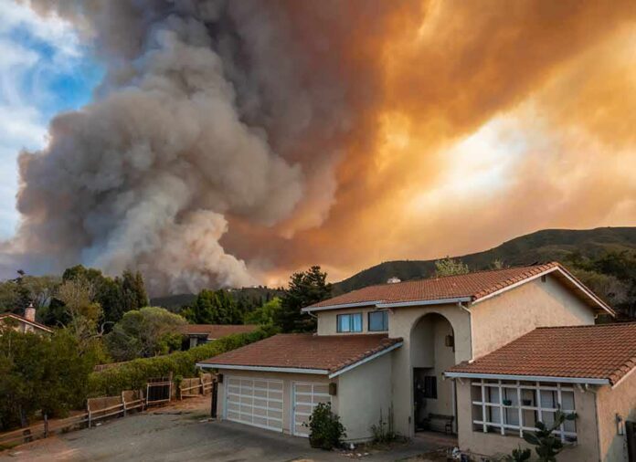
In a single wind-whipped afternoon, a fast-moving wall of fire jumped the Spokane River and pushed into city neighborhoods, forcing families, hospital patients, and entire blocks to flee under “Go Now” orders as the Old Trails Fire turned northwest Spokane into a real-time evacuation map.
Story Snapshot
- Level 3 “Go Now” evacuations raced across northwest Spokane neighborhoods as the Old Trails Fire spread.
- The wildfire jumped the Spokane River into the city, threatening homes, parks, and key infrastructure.
- The Mann-Grandstaff Veterans Affairs Medical Center evacuated patients and staff as flames approached.
- Extreme wind and rare “particularly dangerous” fire weather warnings drove the fire’s explosive growth.
Wind, Warnings, And A Fire That Would Not Stay Rural
The Old Trails Fire did not begin as an urban disaster. It started near Old Trails Road and West Euclid Road west of Spokane, in the Airway Heights area, just after midday on August 1. Within hours, extreme wind and bone-dry air turned a brush fire into a regional crisis. The National Weather Service had already issued a Red Flag Warning and even a rare “Particularly Dangerous Situation” fire warning for central and eastern Washington, with 20 to 30 mile-per-hour southwest winds and gusts up to 50. Those conditions meant any spark near Spokane was loaded like a weapon.
Washington’s governor responded with a statewide emergency and burn ban as the fire grew, and state forester George Geissler said the blaze was threatening thousands of structures. Officials were not dealing with a remote forest burn. Old Trails was chewing quickly through acreage while pushing toward a metro of more than 230,000 residents. Disaster-watch platforms and local maps showed the fire racing from tens of acres to hundreds, then over 500 as it neared Riverside State Park and the Spokane River. In plain language: this was a suburban fire storm pointed at real neighborhoods, not just timber stands.
“Level 3 – Go Now” Becomes A Way Of Life
The clearest signal of danger was not a single acreage number, but the evacuation language. Spokane County emergency managers and local broadcasters repeatedly told residents they were under Level 3 “Go Now” orders, meaning leave immediately. Notices covered areas between Newkirk Road and Trails Road and out toward Westwood Lane and Dowdy Road as the footprint widened. As the fire grew and changed shape, those Level 3 zones expanded north and east toward Strong Road, Francis Avenue, Division Street, and the Spokane River. People did not have time to debate whether it was 1,500 or 2,500 acres; they had time to grab kids, pets, and documents and get out.
Evacuation traffic reflected the chaos. Social video showed gridlocked lines of cars in northwest Spokane as residents tried to escape. Police and emergency management begged people not to drive into the evacuation zone just to look, and to keep key routes, including Francis Avenue, clear as evacuation corridors. That guidance fits basic common sense and conservative principles of personal responsibility: when officials are trying to move entire neighborhoods, sightseeing near a fire line is reckless. Clear roads can be the difference between families getting out and first responders being stuck behind curious drivers.
A Fire Crosses The River And A Hospital Empties
The psychological turning point came when Old Trails jumped the Spokane River. Local outlets and video updates showed flames crossing into city limits, pushing toward northwest Spokane neighborhoods. Riverside State Park and areas near the Dwight Merkel Sports Complex fell inside new Level 3 zones as the fire advanced. That shift from “near Airway Heights” to “inside Spokane” changed how the whole region saw the threat. This was no longer an edge-of-town incident; it was within the urban fabric.
One of the strongest signals of severity was the evacuation of the Mann-Grandstaff Veterans Affairs Medical Center. Local reporting confirmed the hospital moved patients and staff out as the fire approached. Mayor Lisa Brown said several major facilities had been evacuated or put under threat, including water plants and waste-to-energy sites. For many Americans, the idea of veterans being wheeled out under a wildfire sky hits hard. That image captures why fire behavior experts treat high-wind, low-humidity events with such seriousness. You do not evacuate a federal hospital lightly; you do it because the risk to life leaves no margin for error.
Homes Burn, Numbers Shift, And The Limits Of Live Coverage
Reports during the event agreed that structures were threatened and that some homes were burning or likely already lost. Viewers saw video of houses, vehicles, and yards engulfed as fire moved through northwest Spokane blocks. Yet even as journalists and residents captured those scenes, hard numbers stayed fuzzy. Different sources put the fire at 1,500, then 2,000, then about 2,500 acres by late afternoon. Later summaries and online trackers would describe totals over 3,500 acres and “multiple” structures destroyed. That spread is not evidence of a cover-up; it is what happens when you try to measure a moving target in real time.
More than a dozen wildfires are burning across Washington State, with the largest—the Old Trails Fire near Spokane—rapidly growing to about 2,500 acres due to strong winds and extreme heat.
Mandatory evacuations were ordered for parts of Spokane County, including a hospital,… https://t.co/qff2fZXa21 pic.twitter.com/Bd7vJm4eCo
— Adam Scott (@chefcascottccc) August 2, 2026
This confusion fits a wider wildfire pattern. The best early facts are usually the evacuation orders: who was told to leave and how urgent that order was. Damage counts, containment percentages, and final acreage tend to lag, sometimes by days. Fire crews are busy fighting the blaze and moving people out, not auditing each burned shed. Social media clips, 24-hour live streams, and national outlets can unintentionally make rough numbers sound definitive. Skeptical, civic-minded readers should treat “Level 3 – Go Now” as firm, and early acreage as approximate until official incident reports and damage assessments catch up.
What This Says About Preparedness And Personal Duty
The Old Trails Fire shows how fast a city can go from normal to evacuation maps when extreme fire weather meets modern growth. Spokane is a regional hub in a fire-prone state, and development has spread into wildland edges where wind, dry fuels, and homes share the same hillsides. State leaders did their job by issuing burn bans and emergency declarations when the warning lights flashed. Local managers followed through with strong, clear “Go Now” messaging. From a conservative, common-sense lens, the next step falls on residents: heed warnings early, keep roads clear, have a plan for pets and medications, and push officials to keep infrastructure hardened against the next high-wind event.
Sources:
thegatewaypundit.com, khq.com, cnn.com, rollingout.com, krem.com, allfirefighter.com, facebook.com, nytimes.com, instagram.com, kesq.com, spokesman.com, woodlandfirefighter.com, youtube.com